 Mountains and deserts forecast to get 5-7 inches of rain, with winds up to 60 mph
By Miriam Raftery
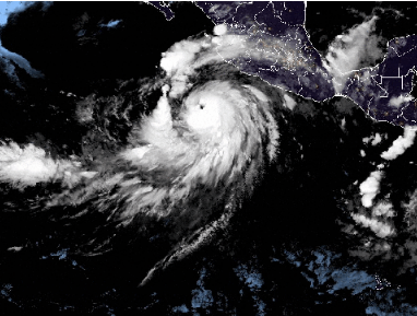
August 17, 2023 (San Diego’s East County) – Hurricane Hilary is barreling toward San DIego County, slated to hit this weekend.
“The storm is going inland, so the strongest winds will be in the mountains,” meteorologist Miguel Miller with the National Weather Service in San Diego told East County Magazine. “The rainfall, flood potential and winds are actually going to be stronger the more east you go. This will be a really wet and windy storm.”
Currently a category 2 hurricane, Hilary could be upgraded to a category 4 by the time it hits Baja, Mexico, though it will likely be downgraded to a tropical storm once it reaches San Diego County. However, the impacts will still pack a wallop, with thunderstorms, very heavy rains and flooding likely --with the worst in inland areas.
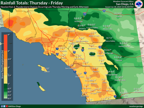
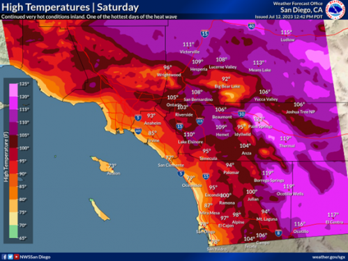
Desert areas are forecast to be soaked with 5-7 inches of rain, with 5-7 inches in the mountains, 2.5 inches in Alpine, and 1.75 inches in El Cajon from Saturday through Monday. The worst of the storm is expected to peak on Sunday.
Wind gusts of 40 to 60 miles per hour are expected in the mountains, with 30 to 50 mph winds on the desert floor. West of the mountains, 30 to 40 mph winds are forecast. High surf will occur along the coast.
This isn’t the first time a hurricane has hit our region.
Back in September 1976, Hurricane Kathleen had a similar trajectory. Designate a tropical cyclone by the time it reached our region, it as ECM previously reported on an anniversary of that storm, it caused massive flooding and destruction.


 East County Wildfire & Emergency Alerts


 By Miriam Raftery


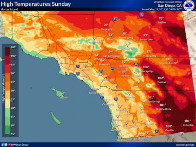
 August 29, 2023 (San Diego) -- The National Weather Service has extended the Excessive Heat Warning for the San Diego County deserts, mountains and valleys through Wednesday, August 30, at 8 p.m.. Temperatures will reach 110 to 117 degrees in the deserts, 95 to 107 in the valleys, and 90 to 100 in the mountains.
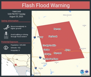 August 20, 2023 (San Diego's East County) --The National Weather Service has issued a flash flood warning now through 5 p.m. for El Cajon, La Mesa, Poway, Ramona, Alpine, Tierrasanta, Escondido, Santee, Lakeside and San Diego Country Estates. This is due to heavy rainfall capable of producing life-threatening flash floods.
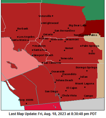


 By Miriam Raftery
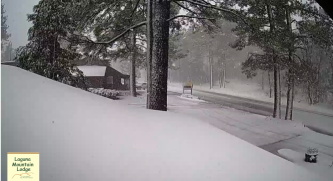
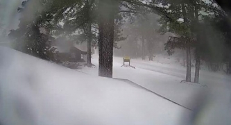
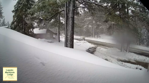
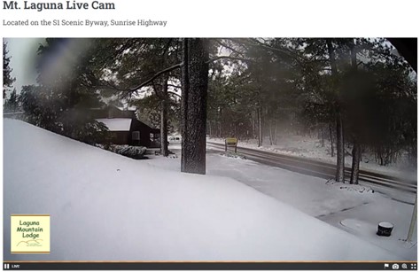
 Photo by Miriam Raftery: Snow at Santa Ysabel
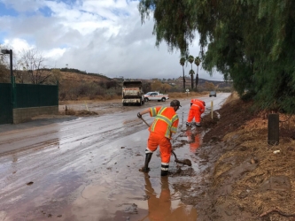 By
By  East County News Service


Recent comments